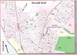
Overview

General 07-Nile Towers-Maadi-SED-Egypt

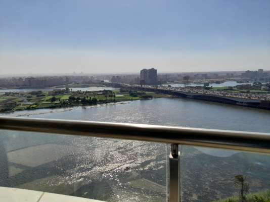
Maadi is a leafy suburban district south of Cairo, Egypt, on the east bank of the Nile about 12 kilometers (7.5 mi) upriver from downtown Cairo. The Nile at Maadi is parallelled by the Corniche, a waterfront promenade, and the main road north into Cairo. There is no bridge across the Nile at Maadi; the nearest one is located at El Mounib along the Ring Road (Tarik El-Da'eri, English: The Round Road) on the way north to the downtown.

Ma’ǎdi is the plural form of the word ma’diyya, , which means “ferry”; hence, El-Ma’adi literally means “The ferries”. There was a story that the name comes from a ferry crossing in the area where ferries carried people from the east side of the Nile to the west.
The oldest area in Maadi is El Sarayat, composed mostly of villas and low rise buildings. It is the most affluent part of Maadi along with the adjacent Degla area. These two areas are recognizable by the high number of roundabouts, quiet atmosphere and greenery.
There are many flats in Maadi, mostly in lowrise buildings. There are several highrises along the Corniche by the river, as well as in the newer, eastern part of Maadi, known as Degla.
The new Maadi areas include El-Laselky St. and the Autostrad, as well as Masaken El Arays, Saqr kuraish and the houses of the Kuwaiti company, and el basatin el sharkya. which is between saqr kuraish and the houses of the Kuwait company. It is characterized by the large number of oil companies, most notably the Gulf of Suez Oil Company, as well as some other companies. The Arab region is also the most popular areas in Maadi and the Arab Maadi which is available from shops and crafts and various means of transport and its location, which connects all areas of Maadi.

Location

Maadi MAP
Maadi MAP

Available Projects

Location

Address

Maadi – Egypt